
Sant Martí topographic map
Interactive map
Click on the map to display elevation.
About this map
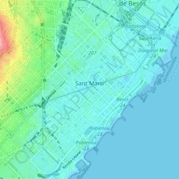
Name: Sant Martí topographic map, elevation, terrain.
Location: Sant Martí, Barcelona, Barcelonès, Barcelona, Catalonia, Spain (41.38334 2.17544 41.43024 2.22836)
Average elevation: 17 m
Minimum elevation: -3 m
Maximum elevation: 109 m
Other topographic maps
Click on a map to view its topography, its elevation and its terrain.