
Arnprior topographic map
Interactive map
Click on the map to display elevation.
About this map
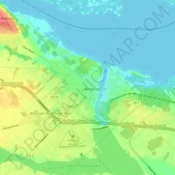
Name: Arnprior topographic map, elevation, terrain.
Location: Arnprior, Renfrew County, Eastern Ontario, Ontario, Canada (45.40219 -76.38726 45.46592 -76.28975)
Average elevation: 94 m
Minimum elevation: 74 m
Maximum elevation: 139 m