
El Quemado topographic map
Interactive map
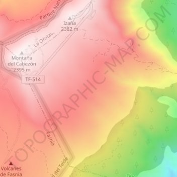
Click on the map to display elevation.
About this map
Name: El Quemado topographic map, elevation, terrain.
Average elevation: 2,146 m
Minimum elevation: 1,608 m
Maximum elevation: 2,387 m
Other topographic maps
Click on a map to view its topography, its elevation and its terrain.
Punta Prieta
Spain > Canary Islands > Güímar > Punta Prieta
Punta Prieta, Güímar, Santa Cruz de Tenerife, Canary Islands, 38560, Spain
Average elevation: 99 m
La Raya
Spain > Canary Islands > Güímar > La Raya
La Raya, Güímar, Santa Cruz de Tenerife, Canary Islands, 38500, Spain
Average elevation: 435 m
San Juan
Spain > Canary Islands > Güímar > San Juan
San Juan, Güímar, Santa Cruz de Tenerife, Canary Islands, 38500, Spain
Average elevation: 566 m