
Inverness topographic map
Interactive map
Click on the map to display elevation.
About this map
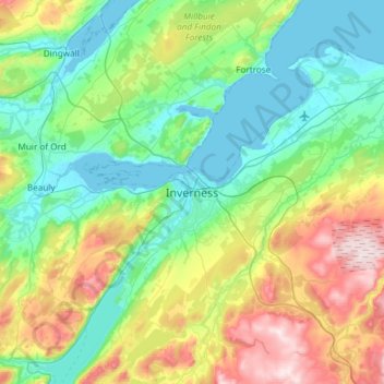
Name: Inverness topographic map, elevation, terrain.
Location: Inverness, Highland, Scotland, IV1 1PQ, United Kingdom (57.31901 -4.38574 57.63901 -4.06574)
Average elevation: 163 m
Minimum elevation: -1 m
Maximum elevation: 615 m
Other topographic maps
Click on a map to view its topography, its elevation and its terrain.
Blackfold
United Kingdom > Scotland > Highland > Inverness
Blackfold, Inverness West, Inverness, Highland, Scotland, IV3 8JY, United Kingdom
Average elevation: 265 m
Thurso
United Kingdom > Scotland > Highland
Thurso, Highland, Scotland, United Kingdom
Average elevation: 25 m