
Peest topographic map
Interactive map
Click on the map to display elevation.
About this map
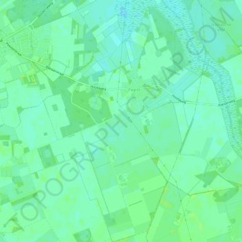
Name: Peest topographic map, elevation, terrain.
Location: Peest, Noordenveld, Drenthe, Nederland (53.03757 6.47503 53.07294 6.51452)
Average elevation: 10 m
Minimum elevation: 5 m
Maximum elevation: 15 m
Other topographic maps
Click on a map to view its topography, its elevation and its terrain.
Roderwolde
Nederland > Drenthe > Noordenveld
Roderwolde, Noordenveld, Drenthe, Nederland
Average elevation: 0 m
Lieveren
Nederland > Drenthe > Noordenveld
Lieveren, Noordenveld, Drenthe, Nederland
Average elevation: 5 m
Steenbergen
Nederland > Drenthe > Noordenveld
Steenbergen, Noordenveld, Drenthe, Nederland
Average elevation: 6 m
Mensinge
Nederland > Drenthe > Noordenveld
Mensinge, Mensingheweg, Roden, Noordenveld, Drenthe, Nederland, 9301 KA, Nederland
Average elevation: 4 m