
Queens topographic map
Interactive map
Click on the map to display elevation.
About this map
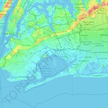
Name: Queens topographic map, elevation, terrain.
Location: Queens, Queens County, New York, USA (40.54233 -73.96269 40.80092 -73.70018)
Average elevation: 12 m
Minimum elevation: -8 m
Maximum elevation: 110 m
Other topographic maps
Click on a map to view its topography, its elevation and its terrain.