
Laguna Niguel topographic map
Interactive map
Click on the map to display elevation.
About this map
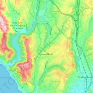
Name: Laguna Niguel topographic map, elevation, terrain.
Location: Laguna Niguel, Orange County, California, 92677, USA (33.48709 -117.74018 33.57141 -117.67251)
Average elevation: 110 m
Minimum elevation: 0 m
Maximum elevation: 308 m