
Prefectura de Nagasaki topographic map
Interactive map
Click on the map to display elevation.
About this map
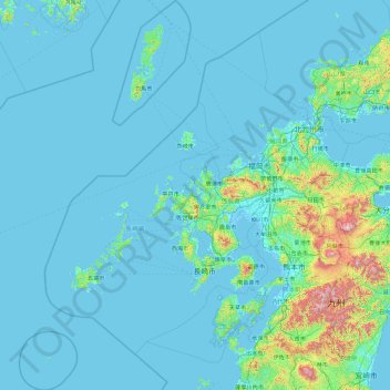
Name: Prefectura de Nagasaki topographic map, elevation, terrain.
Location: Prefectura de Nagasaki, Japón (31.78493 128.10833 34.89174 130.48195)
Average elevation: 89 m
Minimum elevation: -4 m
Maximum elevation: 1,725 m
Other topographic maps
Click on a map to view its topography, its elevation and its terrain.