
Rotselaar topographic map
Interactive map
Click on the map to display elevation.
About this map
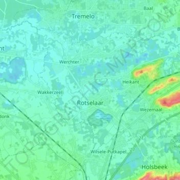
Name: Rotselaar topographic map, elevation, terrain.
Location: Rotselaar, Leuven, Flemish Brabant, Flanders, Belgium (50.92843 4.66995 50.98628 4.80333)
Average elevation: 14 m
Minimum elevation: 3 m
Maximum elevation: 74 m