
Lalafuta river topographic map
Interactive map
Click on the map to display elevation.
About this map
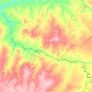
Name: Lalafuta river topographic map, elevation, terrain.
Location: Lalafuta river, Western Province, Zambia (-14.30933 24.68976 -13.96857 25.13524)
Average elevation: 1,160 m
Minimum elevation: 1,079 m
Maximum elevation: 1,236 m
Other topographic maps
Click on a map to view its topography, its elevation and its terrain.