
Aruwimi topographic map
Interactive map
Click on the map to display elevation.
About this map
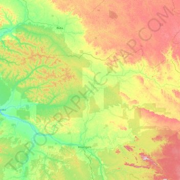
Name: Aruwimi topographic map, elevation, terrain.
Location: Aruwimi, Tshopo, DR Congo (1.22248 23.56821 1.98682 27.00776)
Average elevation: 503 m
Minimum elevation: 359 m
Maximum elevation: 928 m
Other topographic maps
Click on a map to view its topography, its elevation and its terrain.