
Victoria Falls topographic map
Interactive map
Click on the map to display elevation.
About this map
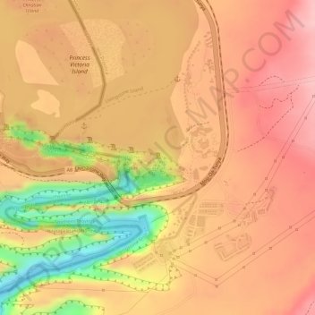
Name: Victoria Falls topographic map, elevation, terrain.
Location: Victoria Falls, Livingstone, Southern Province, Zambia (-17.92612 25.85916 -17.92497 25.86314)
Average elevation: 877 m
Minimum elevation: 758 m
Maximum elevation: 931 m
Other topographic maps
Click on a map to view its topography, its elevation and its terrain.
Livingstone
Zambia > Southern Province > Livingstone
Livingstone, Southern Province, Zambia
Average elevation: 961 m