
Gardaya topographic map
Interactive map
Click on the map to display elevation.
About this map
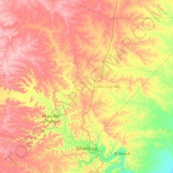
Name: Gardaya topographic map, elevation, terrain.
Location: Gardaya, Daïra Ghardaia, Ghardaïa غرداية, Argelia (32.47352 3.57204 32.70199 3.90997)
Average elevation: 574 m
Minimum elevation: 424 m
Maximum elevation: 702 m
Other topographic maps
Click on a map to view its topography, its elevation and its terrain.
Valle de M'Zab
Argelia > Ghardaïa غرداية > Gardaya
Valle de M'Zab, Gardaya, Daïra Ghardaia, Ghardaïa غرداية, Argelia
Average elevation: 552 m