
Kara Region topographic map
Interactive map
Click on the map to display elevation.
About this map
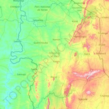
Name: Kara Region topographic map, elevation, terrain.
Location: Kara Region, Togo (8.86096 0.22705 10.21944 1.43500)
Average elevation: 257 m
Minimum elevation: 82 m
Maximum elevation: 837 m
Other topographic maps
Click on a map to view its topography, its elevation and its terrain.