
Gmunden topographic map
Interactive map
Click on the map to display elevation.
About this map
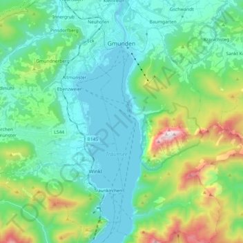
Name: Gmunden topographic map, elevation, terrain.
Location: Gmunden, Upper Austria, 4810, Austria (47.81858 13.77477 47.94020 13.90030)
Average elevation: 692 m
Minimum elevation: 414 m
Maximum elevation: 1,645 m