
Crook County topographic map
Interactive map
Click on the map to display elevation.
About this map
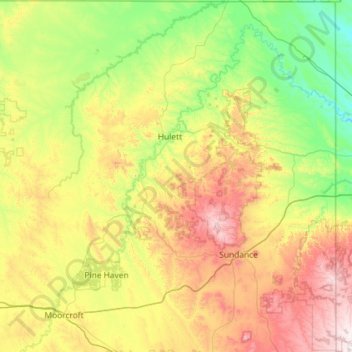
Name: Crook County topographic map, elevation, terrain.
Location: Crook County, Wyoming, United States (44.17913 -105.08957 45.00022 -104.05456)
Average elevation: 1,300 m
Minimum elevation: 941 m
Maximum elevation: 2,098 m
Other topographic maps
Click on a map to view its topography, its elevation and its terrain.
Saratoga
United States > Wyoming > Carbon County
Saratoga, Carbon County, Wyoming, 82331, United States
Average elevation: 2,086 m