
Neebing River topographic map
Interactive map
Click on the map to display elevation.
About this map
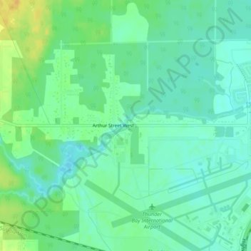
Name: Neebing River topographic map, elevation, terrain.
Average elevation: 197 m
Minimum elevation: 187 m
Maximum elevation: 214 m
Other topographic maps
Click on a map to view its topography, its elevation and its terrain.
Kaministiquia River
Canada > Ontario > Thunder Bay
Kaministiquia River, Thunder Bay, Thunder Bay District, Ontario, P7E 6T9, Canada
Average elevation: 249 m