
Thimphu District topographic map
Interactive map
Click on the map to display elevation.
About this map
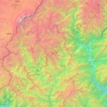
Name: Thimphu District topographic map, elevation, terrain.
Location: Thimphu District, Bhutan (27.14524 89.21960 27.98766 89.81656)
Average elevation: 3,484 m
Minimum elevation: 887 m
Maximum elevation: 7,203 m
Other topographic maps
Click on a map to view its topography, its elevation and its terrain.
Thimphu
Bhutan > Thimphu District > Chang Gewog
Thimphu, Chang Gewog, Thimphu, Thimphu District, 11001, Bhutan
Average elevation: 3,121 m