
Afga topographic map
Interactive map
Click on the map to display elevation.
About this map
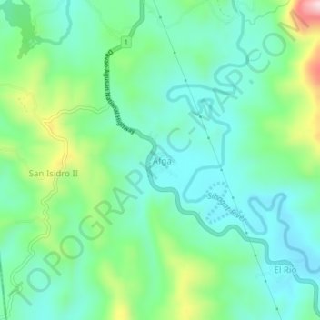
Name: Afga topographic map, elevation, terrain.
Location: Afga, Sibagat, Agusan del Sur, Caraga, 8503, Philippines (8.85379 125.63763 8.89379 125.67763)
Average elevation: 171 m
Minimum elevation: 73 m
Maximum elevation: 441 m