
Boiling Lake topographic map
Interactive map
Click on the map to display elevation.
About this map
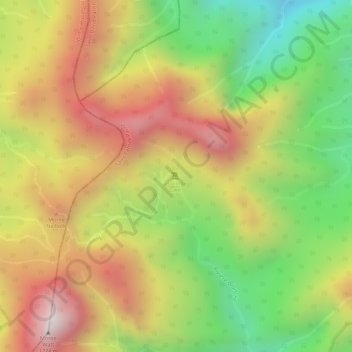
Name: Boiling Lake topographic map, elevation, terrain.
Location: Boiling Lake, Saint Patrick Parish, Dominica (15.31852 -61.29463 15.31862 -61.29453)
Average elevation: 780 m
Minimum elevation: 370 m
Maximum elevation: 1,145 m
Other topographic maps
Click on a map to view its topography, its elevation and its terrain.
Palmiste
Dominica > Saint Patrick Parish > La Plaine
Palmiste, La Plaine, Saint Patrick Parish, Dominica
Average elevation: 409 m