
Berg Lake topographic map
Interactive map
Click on the map to display elevation.
About this map
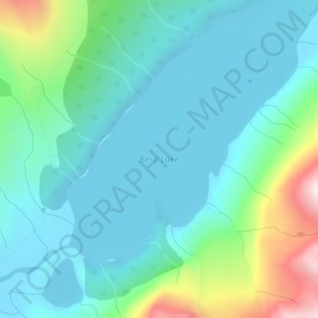
Name: Berg Lake topographic map, elevation, terrain.
Average elevation: 1,798 m
Minimum elevation: 1,635 m
Maximum elevation: 2,413 m
Other topographic maps
Click on a map to view its topography, its elevation and its terrain.
Mastodon Mountain
Canada > Colombie-Britannique > Regional District of Fraser-Fort George > Area H (Robson Valley/Canoe)
Mastodon Mountain, Area H (Robson Valley/Canoe), Regional District of Fraser-Fort George, Colombie-Britannique, Canada
Average elevation: 2,461 m