
Parc de Forest topographic map
Interactive map
Click on the map to display elevation.
About this map
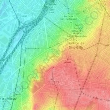
Name: Parc de Forest topographic map, elevation, terrain.
Location: Parc de Forest, Forest, Bruxelles-Capitale, 1190, Belgique (50.82089 4.33422 50.82426 4.34097)
Average elevation: 61 m
Minimum elevation: 15 m
Maximum elevation: 108 m
Other topographic maps
Click on a map to view its topography, its elevation and its terrain.
Flotsenberg
Belgique > Bruxelles-Capitale > Forest
Flotsenberg, Forest, Bruxelles-Capitale, 1190, Belgique
Average elevation: 65 m
Parc du Bempt
Belgique > Bruxelles-Capitale > Forest
Parc du Bempt, Forest, Bruxelles-Capitale, 1190, Belgique
Average elevation: 33 m