
Ötztal Alps topographic map
Interactive map
Click on the map to display elevation.
About this map
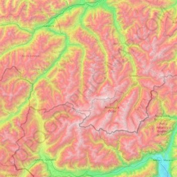
Name: Ötztal Alps topographic map, elevation, terrain.
Average elevation: 2,098 m
Minimum elevation: 257 m
Maximum elevation: 3,723 m
Other topographic maps
Click on a map to view its topography, its elevation and its terrain.
Wildspitze
Wildspitze, Sölden, Imst, Tyrol, 6458, Austria
Average elevation: 3,284 m