
Vorden topographic map
Interactive map
Click on the map to display elevation.
About this map
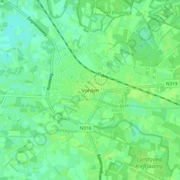
Name: Vorden topographic map, elevation, terrain.
Location: Vorden, Gelderland, Nederland, 7251, Nederland (52.08411 6.29261 52.12411 6.33261)
Average elevation: 13 m
Minimum elevation: 7 m
Maximum elevation: 17 m
Other topographic maps
Click on a map to view its topography, its elevation and its terrain.
Hackfort
Nederland > Gelderland > Vorden
Hackfort, Vorden, Bronckhorst, Gelderland, Nederland
Average elevation: 11 m
Delden
Nederland > Gelderland > Vorden
Delden, Vorden, Bronckhorst, Gelderland, Nederland, 7251 PZ, Nederland
Average elevation: 12 m