
Sălaj topographic map
Interactive map
Click on the map to display elevation.
About this map
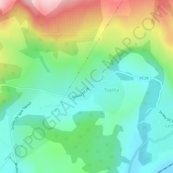
Name: Sălaj topographic map, elevation, terrain.
Location: Toplița, Sălaj, 457223, Romania (47.35521 23.46127 47.36188 23.47444)
Average elevation: 292 m
Minimum elevation: 200 m
Maximum elevation: 479 m
Other topographic maps
Click on a map to view its topography, its elevation and its terrain.
Piatra Fântânele
Piatra Fântânele, Bistrița-Năsăud, 427363, Romania
Average elevation: 1,080 m
Retezat National Park
Retezat National Park, Hunedoara, Romania
Average elevation: 1,443 m