
Thep Sathit topographic map
Interactive map
Click on the map to display elevation.
About this map
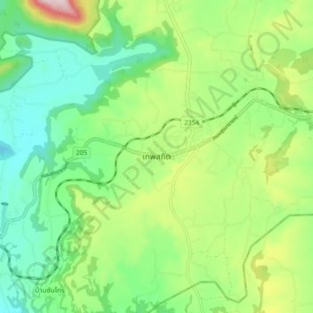
Name: Thep Sathit topographic map, elevation, terrain.
Location: Thep Sathit, Chaiyaphum Province, Thailand (15.34394 101.39300 15.42394 101.47300)
Average elevation: 294 m
Minimum elevation: 150 m
Maximum elevation: 590 m