
Lahat topographic map
Interactive map
Click on the map to display elevation.
About this map
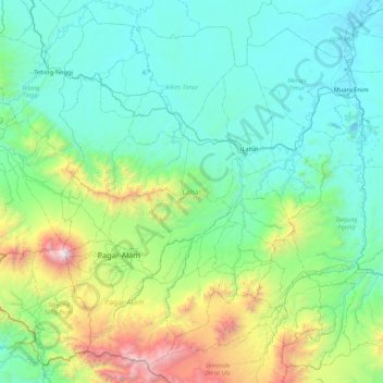
Name: Lahat topographic map, elevation, terrain.
Location: Lahat, South Sumatra, Indonesia (-4.26783 102.91236 -3.48978 103.77321)
Average elevation: 576 m
Minimum elevation: 21 m
Maximum elevation: 3,139 m