
East Khasi Hills topographic map
Interactive map
Click on the map to display elevation.
About this map
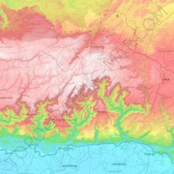
Name: East Khasi Hills topographic map, elevation, terrain.
Location: East Khasi Hills, Meghalaya, India (25.12667 91.35476 25.72171 92.15713)
Average elevation: 956 m
Minimum elevation: 4 m
Maximum elevation: 1,957 m
Other topographic maps
Click on a map to view its topography, its elevation and its terrain.
Khasi Hills
India > Meghalaya > Mawshynrut
Khasi Hills, Mawshynrut, West Khasi Hills District, Meghalaya, India
Average elevation: 349 m