
Clavon topographic map
Interactive map
Click on the map to display elevation.
About this map
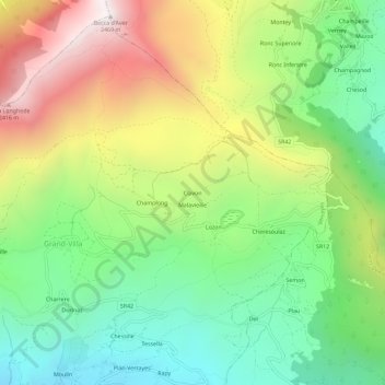
Name: Clavon topographic map, elevation, terrain.
Location: Clavon, Verrayes, Aosta Valley, Italy (45.76237 7.52789 45.80237 7.56789)
Average elevation: 1,574 m
Minimum elevation: 987 m
Maximum elevation: 2,450 m