
Hillcrest topographic map
Interactive map
Click on the map to display elevation.
About this map
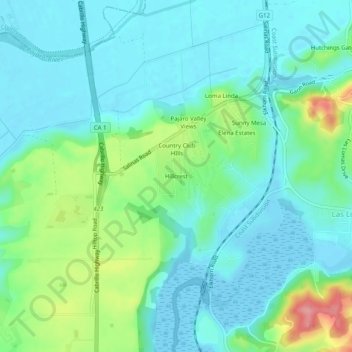
Name: Hillcrest topographic map, elevation, terrain.
Location: Hillcrest, Monterey County, California, United States (36.84955 -121.77978 36.88955 -121.73978)
Average elevation: 25 m
Minimum elevation: -9 m
Maximum elevation: 105 m