
Petasse topographic map
Interactive map
Click on the map to display elevation.
About this map
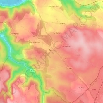
Name: Petasse topographic map, elevation, terrain.
Location: Petasse, Gourdon, Lot, Occitania, Metropolitan France, France (44.84026 1.60991 44.88026 1.64991)
Average elevation: 232 m
Minimum elevation: 103 m
Maximum elevation: 288 m