
Baiyun District topographic map
Interactive map
Click on the map to display elevation.
About this map
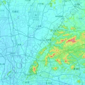
Name: Baiyun District topographic map, elevation, terrain.
Location: Baiyun District, Guangzhou City, Guangdong, PRC (23.14065 113.14523 23.42988 113.50508)
Average elevation: 40 m
Minimum elevation: -9 m
Maximum elevation: 513 m
Other topographic maps
Click on a map to view its topography, its elevation and its terrain.
Jinkeng Reservoir
PRC > Guangdong > Guangzhou City > Jinkeng Village
Jinkeng Reservoir, Shuiku Road, Jinkeng Village, Huangpu District, Guangzhou City, Guangdong, PRC
Average elevation: 101 m