
Glarus Süd topographic map
Interactive map
Click on the map to display elevation.
About this map
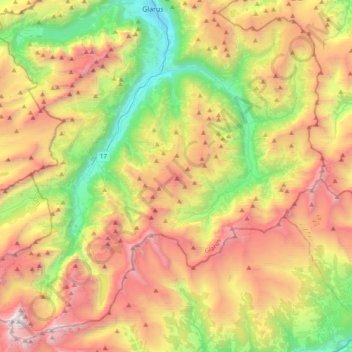
Name: Glarus Süd topographic map, elevation, terrain.
Location: Glarus Süd, Glarus, Switzerland (46.79647 8.87123 47.03996 9.25258)
Average elevation: 1,835 m
Minimum elevation: 472 m
Maximum elevation: 3,576 m