
Kampung Batu 10 Cheras topographic map
Interactive map
Click on the map to display elevation.
About this map
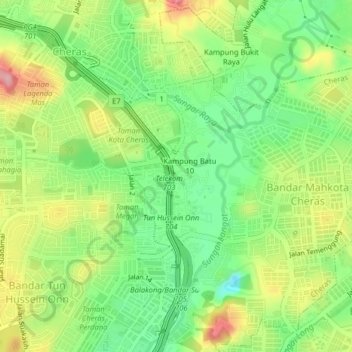
Name: Kampung Batu 10 Cheras topographic map, elevation, terrain.
Location: Kampung Batu 10 Cheras, Selangor, 43200, Malaysia (3.03885 101.75488 3.07885 101.79488)
Average elevation: 61 m
Minimum elevation: 0 m
Maximum elevation: 144 m