
Pájara topographic map
Interactive map
Click on the map to display elevation.
About this map
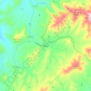
Name: Pájara topographic map, elevation, terrain.
Location: Pájara, Las Palmas, Canary Islands, 35628, Spain (28.30979 -14.14809 28.38979 -14.06809)
Average elevation: 283 m
Minimum elevation: 60 m
Maximum elevation: 711 m