La Motte-d'Aveillans topographic map
Interactive map
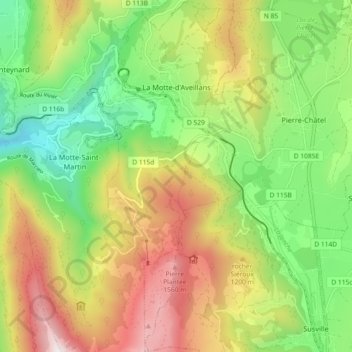
Click on the map to display elevation.
About this map
Name: La Motte-d'Aveillans topographic map, elevation, terrain.
Average elevation: 1,043 m
Minimum elevation: 553 m
Maximum elevation: 1,704 m

Click on the map to display elevation.
Name: La Motte-d'Aveillans topographic map, elevation, terrain.
Average elevation: 1,043 m
Minimum elevation: 553 m
Maximum elevation: 1,704 m