
奄美大島 topographic map
Interactive map
Click on the map to display elevation.
About this map
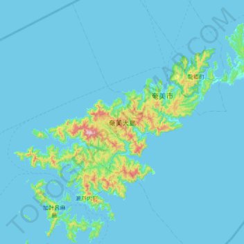
Name: 奄美大島 topographic map, elevation, terrain.
Location: 奄美大島, 大和村, 大島郡, Prefectura de Kagoshima, 九州地方, Japón (28.10893 129.13383 28.53088 129.72213)
Average elevation: 39 m
Minimum elevation: 0 m
Maximum elevation: 684 m