
Portmore topographic map
Interactive map
Click on the map to display elevation.
About this map
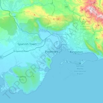
Name: Portmore topographic map, elevation, terrain.
Location: Portmore, Saint Catherine, Middlesex County, Jamaica (17.81179 -77.03380 18.13179 -76.71380)
Average elevation: 148 m
Minimum elevation: -2 m
Maximum elevation: 1,463 m