Geolocate

The Anvil topographic map

Interactive map

Click on the map to display elevation.

About this map

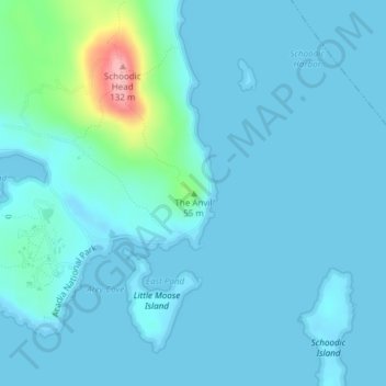
Name: The Anvil topographic map, elevation, terrain.

Location: The Anvil, Hancock County, Maine, 04613, USA (44.34170 -68.04589 44.34180 -68.04579)

Average elevation: 14 m

Minimum elevation: -2 m

Maximum elevation: 128 m

Other topographic maps

Click on a map to view its topography, its elevation and its terrain.

Middle Island

USA > Maine

Middle Island, Washington County, Maine, USA

Average elevation: 58 m

Mount Ararat

USA > Maine

Mount Ararat, Sagadahoc County, Maine, 04086, USA

Average elevation: 34 m

Cunningham Mountains

USA > Maine

Cunningham Mountains, Penobscot County, Maine, USA

Average elevation: 262 m

Midway Island

USA > Maine

Midway Island, Kennebec County, Maine, USA

Average elevation: 107 m