Geolocate

Slot Zeist topographic map

Interactive map

Click on the map to display elevation.

About this map

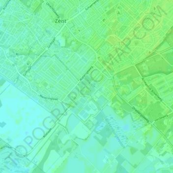
Name: Slot Zeist topographic map, elevation, terrain.

Location: Slot Zeist, slotplein, Zeist, Utrecht, Nederland, 3703DX, Nederland (52.07864 5.23401 52.07936 5.23520)

Average elevation: 6 m

Minimum elevation: 0 m

Maximum elevation: 11 m

Other topographic maps

Click on a map to view its topography, its elevation and its terrain.

Zeist

Nederland > Utrecht > Zeist

Zeist, Utrecht, Nederland

Average elevation: 8 m

Austerlitz

Nederland > Utrecht > Zeist

Austerlitz, Zeist, Utrecht, Nederland

Average elevation: 20 m

Den Dolder

Nederland > Utrecht > Zeist

Den Dolder, Zeist, Utrecht, Nederland

Average elevation: 7 m

Bosch en Duin

Nederland > Utrecht > Zeist

Bosch en Duin, Zeist, Utrecht, Nederland

Average elevation: 9 m

Huis ter Heide

Nederland > Utrecht > Zeist

Huis ter Heide, Zeist, Utrecht, Nederland

Average elevation: 12 m