
Kanacea Island topographic map
Interactive map
Click on the map to display elevation.
About this map
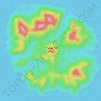
Name: Kanacea Island topographic map, elevation, terrain.
Location: Kanacea Island, Eastern, Fiji (-17.28359 -179.17009 -17.24662 -179.12991)
Average elevation: 52 m
Minimum elevation: -5 m
Maximum elevation: 244 m
Other topographic maps
Click on a map to view its topography, its elevation and its terrain.