
Lake Bangweulu topographic map
Interactive map
Click on the map to display elevation.
About this map
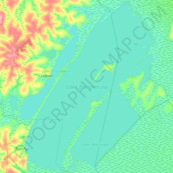
Name: Lake Bangweulu topographic map, elevation, terrain.
Location: Lake Bangweulu, Luapula Province, Zambia (-11.45436 29.56040 -10.84032 30.03397)
Average elevation: 1,172 m
Minimum elevation: 1,160 m
Maximum elevation: 1,240 m
Other topographic maps
Click on a map to view its topography, its elevation and its terrain.
Mwense
Zambia > Luapula Province > Mwense
Mwense, Luapula Province, P.O BOX 760001 MWENSE, Zambia
Average elevation: 990 m
Bangweulu Wetlands
Bangweulu Wetlands, Luapula Province, Zambia
Average elevation: 1,207 m