
金巢开发区 topographic map
Interactive map
Click on the map to display elevation.
About this map
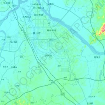
Name: 金巢开发区 topographic map, elevation, terrain.
Location: 金巢开发区, Linchuan District, Fuzhou City, Jiangxi, China (27.82399 116.29982 28.00908 116.44782)
Average elevation: 52 m
Minimum elevation: 28 m
Maximum elevation: 278 m
Other topographic maps
Click on a map to view its topography, its elevation and its terrain.
Yushan
China > Jiangxi > Yushan County > Bingxi Subdistrict
Yushan, Bingxi Subdistrict, Yushan County, Shangrao, Jiangxi, China
Average elevation: 184 m
Anyuan
China > Jiangxi > Anyuan County > Anyuan
Anyuan, Anyuan County, Ganzhou, Jiangxi, China
Average elevation: 530 m