
Izgrev topographic map
Interactive map
Click on the map to display elevation.
About this map
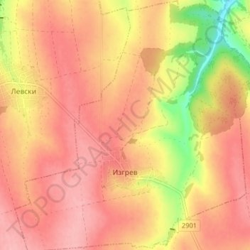
Name: Izgrev topographic map, elevation, terrain.
Location: Izgrev, Suvorovo, Varna, Bulgaria (43.28260 27.66632 43.32994 27.73023)
Average elevation: 339 m
Minimum elevation: 260 m
Maximum elevation: 377 m
Other topographic maps
Click on a map to view its topography, its elevation and its terrain.