
Vidrare topographic map
Interactive map
Click on the map to display elevation.
About this map
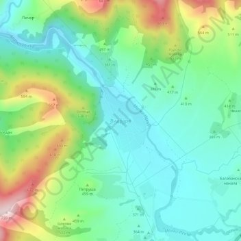
Name: Vidrare topographic map, elevation, terrain.
Location: Vidrare, Pravets, Sofia, 2166, Bulgaria (42.97370 23.99001 43.01370 24.03001)
Average elevation: 421 m
Minimum elevation: 293 m
Maximum elevation: 722 m
Other topographic maps
Click on a map to view its topography, its elevation and its terrain.