Geolocate

Dieuze topographic map

Interactive map

Click on the map to display elevation.

About this map

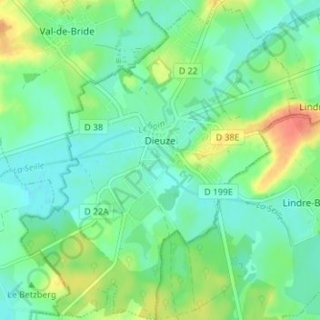
Name: Dieuze topographic map, elevation, terrain.

Location: Dieuze, Sarrebourg-Château-Salins, Moselle, Grand Est, Metropolitan France, 57260, France (48.78732 6.69049 48.82863 6.74464)

Average elevation: 216 m

Minimum elevation: 201 m

Maximum elevation: 247 m

Other topographic maps

Click on a map to view its topography, its elevation and its terrain.

Aspach

France > Grand Est > Moselle

Aspach, Sarrebourg-Château-Salins, Moselle, Grand Est, Metropolitan France, 57790, France

Average elevation: 317 m

Vernéville

France > Grand Est > Moselle

Vernéville, Metz, Moselle, Grand Est, Metropolitan France, 57130, France

Average elevation: 306 m

Klang

France > Grand Est > Moselle

Klang, Thionville, Moselle, Grand Est, Metropolitan France, 57920, France

Average elevation: 275 m