
Thank you for supporting this site ❤️
Make a donation
Make a donation
Houghton County topographic map
Click on the map to display elevation.
Thank you for supporting this site ❤️
Make a donation
Make a donation
About this map
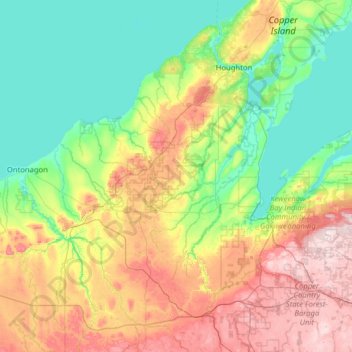
Name: Houghton County topographic map, elevation, terrain.
Location: Houghton County, Michigan, United States (46.41969 -88.99122 47.28610 -88.22737)
Average elevation: 298 m
Minimum elevation: 174 m
Maximum elevation: 596 m
Thank you for supporting this site ❤️
Make a donation
Make a donation
Other topographic maps
Click on a map to view its topography, its elevation and its terrain.