
Thank you for supporting this site ❤️
Make a donation
Make a donation
Eberbach-Seltz topographic map
Click on the map to display elevation.
Thank you for supporting this site ❤️
Make a donation
Make a donation
About this map
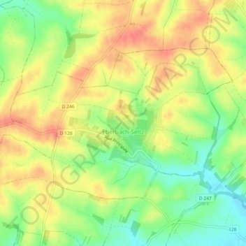
Name: Eberbach-Seltz topographic map, elevation, terrain.
Average elevation: 167 m
Minimum elevation: 136 m
Maximum elevation: 193 m
Thank you for supporting this site ❤️
Make a donation
Make a donation
Other topographic maps
Click on a map to view its topography, its elevation and its terrain.
Thank you for supporting this site ❤️
Make a donation
Make a donation
Thank you for supporting this site ❤️
Make a donation
Make a donation
Thank you for supporting this site ❤️
Make a donation
Make a donation
Quartier des Aviateurs
France > Grand Est > Bas-Rhin > Sélestat > Quartier des Aviateurs
Average elevation: 175 m