
Thank you for supporting this site ❤️
Make a donation
Make a donation
Thanh Hóa topographic map
Click on the map to display elevation.
Thank you for supporting this site ❤️
Make a donation
Make a donation
About this map
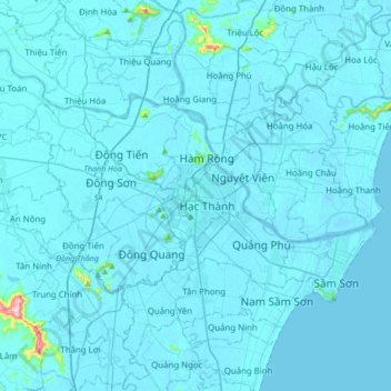
Name: Thanh Hóa topographic map, elevation, terrain.
Location: Thanh Hóa, Thanh Hóa Province, 45000, Vietnam (19.64768 105.61674 19.96768 105.93674)
Average elevation: 9 m
Minimum elevation: -3 m
Maximum elevation: 385 m
Thank you for supporting this site ❤️
Make a donation
Make a donation