
Thank you for supporting this site ❤️
Make a donation
Make a donation
Stargard topographic map
Click on the map to display elevation.
Thank you for supporting this site ❤️
Make a donation
Make a donation
About this map
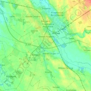
Name: Stargard topographic map, elevation, terrain.
Location: Stargard, Stargard County, West Pomeranian Voivodeship, Poland (53.25538 14.93850 53.36268 15.08474)
Average elevation: 30 m
Minimum elevation: 15 m
Maximum elevation: 57 m
Thank you for supporting this site ❤️
Make a donation
Make a donation